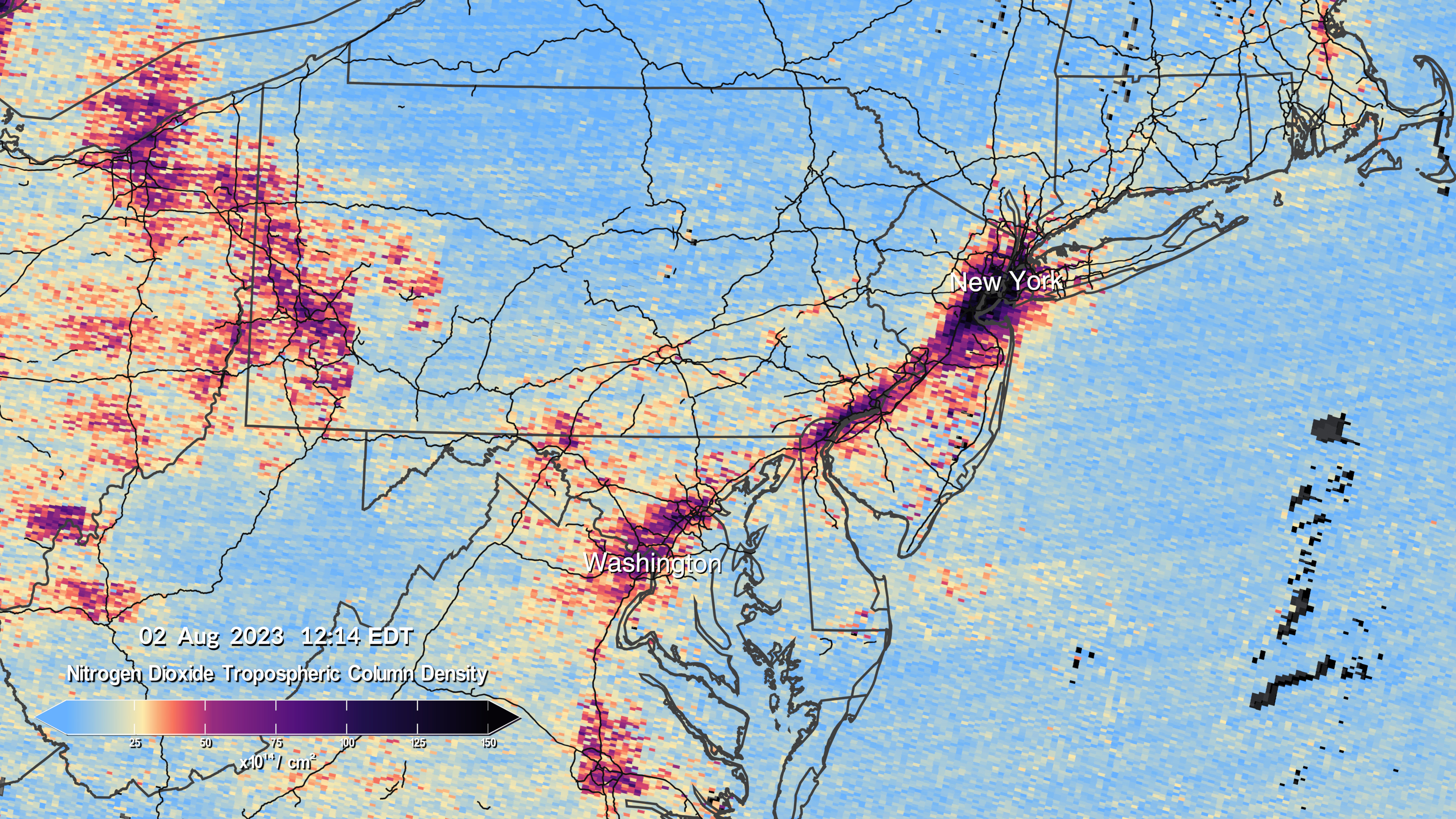
On Thursday, NASA released the first data maps from its new instrument launched to space earlier this year, which now is successfully transmitting information about major air pollutants over North America.
While it does track high population areas, it’s important to monitor how it spreads. There’s some blips showing up in the ocean where obviously nobody lives. Maps like these could give us information about not only the biggest polluters, but the downstream recipients of said pollution.
I’ve also heard of new efforts starting to be used on a local level to identify exact sources of pollution more recent, original study I saw. I’m hopeful that new data being fed into those models, from satellites like this, will help identify individual culprits of specific pollution faster. I’m really thinking of areas where’s there’s dozens of companies and all are following the rules and operating responsibly, but one is cheating. I want to find that cheating one ASAP and put an end to the cheating.